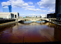
“Imagine the Schuylkill as a Philly’s Seine,” read the headline of an Inquirer editorial from the mid-’90s. “It’s not as far-fetched as you think.”
The Philadelphia-as-Paris comparison may seem a bit ambitious, but as the city’s attention remains riveted on the Delaware waterfront, big changes have been taking place along the edge of its tough-to-spell counterpart.
You can’t miss the Cira Centre, but have you had a chance to check out Schuylkill River Park? Did you know there are at least two elegant high-rises in the works around 23rd Street? Are you aware Penn is buying up most of the underused Postal Service property on the river’s “left” bank, with grandiose plans to turn it into a combination of retail, offices, housing and athletic fields? And that a group of Penn urban planning students have proposed a plan to get rid of the Schuylkill Expressway?
Wait. Get rid of the what?
Well, not get rid of it exactly. But last spring the Penn group presented a plan to deck over I-76 with a riverfront boulevard, complete with landscaping, benches and a pedestrian promenade facing the Center City skyline.
Twenty-ninth Street as the Champs-Elysee? To borrow a quote: It’s not as far-fetched as you think.
The “Sure-Kill Distressway” has been an eyesore since before it even opened. The four lanes of what Mayor Richardson Dilworth called “the worst mistake of my administration” skirt the Schuylkill’s west bank, effectively cutting Center City off from West Philadelphia.
As Center City pushes west and University City pushes east, the Expressway remains the biggest impediment to unifying these two growing areas.
“It’s a huge psychological divide,” says Julie Donofrio, a student who helped draft the proposal. “Keeping [the Expressway] on a lower level and pedestrians up top seems a pretty natural solution.”
“It’s an investment in the city that’ll pay off,” says Schuylkill River Development Corporation (SRDC) CEO Joe Syrnick of the boulevard plan. “Not in one day, but over time.”
The most obvious precedent for decking over an urban highway is the Central Artery in Boston, better known as the Big Dig. Over the course of nearly 20 years engineers sunk a 3.5-mile stretch of highway underneath the city, creating a stretch of parkland where before there’d been only a crumbling overpass. According to the students’ proposal, similar projects are underway in more than 20 other American cities.
The boulevard idea originated as part of a school assignment, says Donofrio. But when the students presented their plan to some of the stakeholders in the area last spring, a funny thing happened.
“Everyone really liked it,” she says.
Of all the organizations with a stake in the area, Donofrio says every single one expressed interest in the idea.
Not that there weren’t issues. “Costs, traffic, train service interruptions,” she says. “These kinds of concerns can hold up a vision like this.”
Still, the proposal had some powerful supporters, among them a high-ranking member of Penn’s Facilities and Real Estate department, which is in charge of new development.
Penn is close to acquiring most of the land fronting the Expressway, and it envisions the campus pushing all the way east to the highway’s edge. Replacing the interstate with a boulevard would eliminate the final barrier between the university and the river.
Penn had considered a similar idea as part of its plan for developing the new land, but ultimately rejected it as too inconvenient and expensive.
Some thought the students’ plan had a better chance of succeeding. It was “an exciting, big idea,” says their professor and Center City District president Paul Levy.


